Using AI and Land Surveying to Reduce Ukraine’s Potentially Mine-Contaminated Land by 30%

Maksym Tkachenko, Co-founder of the Public Union Ukrainian Demining Cluster
Currently, approximately 140,000 square kilometers of Ukrainian land are considered potentially mine-contaminated. These areas have been classified as potentially hazardous due to the presence of explosive remnants, based on direct and indirect evidence such as verbal reports from residents, visible explosion craters, records of past military operations or defensive positions, and reports of accidents. The collection and analysis of this information fall under the non-technical survey (NTS), a method of assessing the safety of an area without using specialized mine-detection equipment. Essentially, a hypothesis is made that a given territory contains explosive hazards, and it is designated as "mine-contaminated."
However, modern equipment and high-tech sensors can rapidly confirm or refute such assumptions. By using these technologies, a second, more precise non-technical survey can be conducted to identify genuinely hazardous areas. With improved data accuracy, up to 30% of currently designated mine-contaminated areas could be reclassified as "safe" solely through scanning. This, in turn, significantly reduces operational costs for subsequent demining efforts.
Several companies in Ukraine are already utilizing advanced sensors for this purpose. Among them is the Danish-Ukrainian company Dropla Tech, which, benefiting from favorable weather conditions this winter, has actively tested AI-powered field inspections.
In particular, the company surveyed 260 hectares across Ukraine’s southern and eastern regions, identifying approximately 200 potentially hazardous objects. Among the findings were TM-62 anti-tank mines, POM-3 bounding fragmentation mines, artillery shell casings, rocket fragments, unexploded Uragan munitions, and debris.
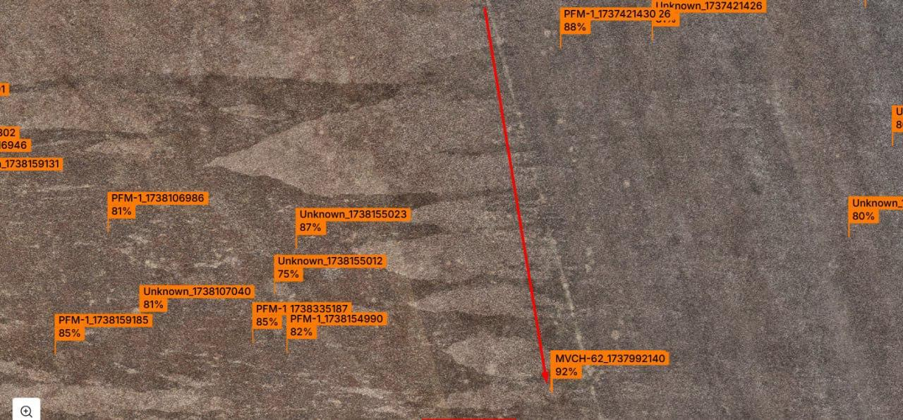
These datasets, collected by drones, are then processed by artificial intelligence and uploaded to a neural network. The system generates a three-tier hazard map, categorizing areas as: Green: No detected hazardous objects. Yellow: Possible contamination. Red: Potentially dangerous objects identified.This classified map is then made available to demining operators for field use.
On average, drones can survey up to 50 hectares per day. This means that, using modern technology, scanning Ukraine’s entire suspected mine-contaminated territory could be completed within three years.
Moreover, this spring, Dropla Tech will unveil a groundbreaking new approach to terrain scanning and demining.
Cutting-edge technologies and sensors are being developed and tested within the Ukrainian Demining Cluster—an initiative bringing together IT experts, scientists, innovative technology firms, over 60 international and domestic demining operators, financial partners, and training centers specializing in humanitarian mine action.
In March, the Cluster will launch Ukraine’s first dedicated R&D hub for mine action, focusing on developing and implementing new technical solutions for demining operations.
One of the most pressing challenges is finding effective solutions for demining Ukraine’s forests. Today, approximately 500,000 hectares of forested land remain contaminated with explosive hazards. The Cluster is engaging experts and developing specialized robotic systems to address this issue and restore Ukraine’s land and natural resources to the people.
Forest demining represents a new frontier in AI-driven mine detection—one that the Cluster and its partners are actively researching. Our primary goal is clear: to assist Ukraine, provide ready-to-deploy solutions, and accelerate the clearance of all mine-affected areas, erasing the remnants of war from our land.

